A group of my friends periodically comes together in (increasingly) far-flung parts of the world to remind each other of our mutual affection. The most recent round took us to Newfoundland, a ragged slash of land off the Eastern coast of Canada. The ostensible object was the Long Range Traverse, a trail across the mountains that run the length of Newfoundland’s Gros Morne National Park. This was as unlikely a mission as any for this particular crew. I wouldn’t say that we’re wholly unathletic, but it’s not what springs to mind. That said, we’re all reasonably competent at various things—from television trivia to expounding conservative ideology—so with a bit of prep (see below), it worked out. It was pretty, too.
Before Leaving
Reserve flights to YDF, Deer Lake. These cost a small fortune. All of our flights went through Toronto.
Make LRT permit reservations with the Gros Morne park office. Another small fortune ($80 each or so)
Hotel reservations on either side. We went with the Holiday Inn Express, which was definitely the top-end of the market. That’s just how we roll.
Car rental for the duration, though it spent most of the time sitting in the trailhead parking lot. Seemed essential nonetheless.
Scheduling “taxi” drop-off at Western Brook Pond trailhead.
Getting map &GPS waypoints (I actually didn’t see these for sale at the welcome center, but could’ve missed them).
Reserving ferry tickets to be dropped off at trailhead. Actually, not sure if these were reserved. Jesse definitely checked the times though.
That was about it, I believe. I didn’t do any of this. I mostly confined myself to perusing various online travel guides and figuring out how to use a little GPS gadget I’d purchased for the occasion. After some wrangling, I managed to load on the free Ibycus Topo Maps, that provide detailed coverage of all of Canada. For those new to the world of GPS devices and the like, it’s a pain—a network of proprietary devices and file formats, custom-made tools for conversions, well-intentioned corporate efforts at cross compatibility, etc. For good measure, I also ordered the necessary (paper) topo map as a fall-back (012H12-P).
Note: all of the photos here are courtesy of my dear friend Anton, who among his many talents, is a fantastic photographer. Thanks, Anton!
Day 0: Getting Set
We assembled at Deer Lake, where the airport is, but that’s a solid hour or so from Gros Morne itself. Joe’s flight was delayed, which made it mildly more complex. And there was some kind of elaborate blasting operation taking place on the single road to Grose Morne, so we ended up arriving at the visitor center towards the end of the day. I don’t know why I thought it’d be less developed, but it was one of those solid, rustic buildings with carpet and bits of antler and everything.
Some pre-trip pontificating. Waiting for Joe to land.
After announcing that we had reservations for the LRT, we were directed over to a sunken auditorium, where a somber video introduced us to the trail. This was the first indication that thing wouldn’t be quite as rugged as anticipated. How many trails have full-blown taped introductions?
The Test
To get issued tickets for the LRT, you’ve got to pass a written basic wilderness navigation exam. We were all a bit nervous about this, having essentially zero experience. The internet had various rumblings about it; it didn’t seem difficult, but some hikers had been delayed while trying to convince the rugged characters up there that they were fit to take the trail. That, and the standard issue emergency GPS beacon that everyone is issued gave the endeavour a serious, dramatic air.
Great minds assemble (this photo, and every other, courtesy of Anton Troianovski).
Navigation-wise, after watching a few YouTube videos and trying to wrap my mind around declination and such, I felt reasonably prepared. We needn’t of worried. The test itself is only 20 or so questions, a few typewritten sheets: take various readings off of a map, identify where you might read the scale, measure the declination, grade-school stuff. While I’d imagined we’d be in a room with a stern, weathered Canadian outdoorsman, the whole affair was much more casual. We got to take the test off to a table in the visitor center and work together as a group. And the particular photocopy we’d been issued happened to have the answer key stapled to the reverse. Oops. I pointed this out to the rangers when we returned it to the desk, so I imagine that particularly oversight has been corrected (sorry), but overall, it wasn’t a big deal.
We passed with flying colors, though I’ll admit, that doesn’t prove much. And it seemed like we had a better sense of some of the answers than the ranger. Passed, OK. But I wasn’t exactly sure how we were going to cope on the trail.
After a solid dinner at Earle’s (at least I thought so)—Moose Burgers, Peanut Butter milkshakes, and other assorted Newfie delicacies—and we spent the night at a campground that Anton had scoped out, Green Point, just north of town.
Fish & brewis w/ scrunchions.
It was a nice, developed campground. We got there a bit late in the day to really enjoy the beach, but it was a beautiful spot. We divied up some supplies, food, etc., in the back of our rented minivan. I, of course, was stressed about the relative weight distribution, as well as the self-appointed navigator dude, somewhat apprehensive about the ‘morrow.
Day 1: We Begin
We drove out to the end-point of the LRT, which is just a few minutes from the visitors center. Most people do it this way—North to South—and were met there by a pair of friendly locals who moonlight a “taxi” service. Jesse made the reservations, I think, so I don’t recall the exact details. I do know that one of the fellows ran Pittman’s Restarurant in Norris Point. Or maybe Pittman’s Inn in Rock Harbor. Something like that.
They charged, I believe, $20 each, which like most things in Newfoundland, seemed a bit steep, but what-the-hey. Anyhow, the system worked well enough. We piled in and they drove us up to Western Brook Pond, where we’d been instructed to begin the trip. The Pond is a capped fjord, a long jet of water between steep cliffs. After being dropped off by our drivers (who gamely snapped our photo), we walked the mile-or-two of boardwalk that spans the swamp between the coast and the pond. Upon arrival, we encountered our first mini fiasco: a gruff, intimidating ship captain, who eyeing our packs, informed us that we’d screwed up—the 11:30 ferry was too big to stop at the small dock that we’d have to be dropped off at: we were supposed to be on the small boat that only left at 9:00AM.
Jesse, our planner-in-chief, was disconsolate. He’d called and asked this very question, and the woman he spoke to had insisted just the opposite. Nevertheless, despite the warning, the boat boss said “he’d do his best to drop us off,” leaving off with a significant shrug. What would happen if we didn’t manage to get to the trailhead wasn’t immediately clear. No matter; we bought our tickets—$33 dollars apiece. We’d cleverly left our credit cards behind in the car (what kind’ve backwoods adventurer carries plastic?) so in another panicked moment, we pooled our emergency cash reserves and came up with the request $200CAD or so. Off we went! Every place we went too was happy to take USD (along with the favorable exchange rate).
The weather was great and the ferry ride was lovely. Concern over the drop-off gradually dissipated. It seemed clear that there was some element of manly psuedo-drama in the captain’s warning: we’d met a trio of hikers who’d be starting down the trail with us who were in the same situation. We also met another fellow from Somerville, MA (Union Square, actually), on some intermediary leg of a vast cross-continental tour (and from whom Mishy immediately extracted various personal details—”Will you and your girlfriend get married?” Maybe.)
Sights!
Left to our fate at the end of Western Brook Pond.
Setting off.
The drop-off wasn’t anything to worry about after all. The captain brought the boat around slowly, and though they didn’t tie down, we easily stepped off on to the dock. We paused there for a moment, and after getting our bearings and clicking “go” on the GPS, set off. A very clearly marked trail led us up the gorge, through thick, almost tropical growth. As we ascended the gorge, the path become somewhat less clear—but it was tough to get lost. The gorge was narrow, and well, we were just going up it.
Just a few miles from the trailhead, this was, funnily enough, where we go the most lost—or at least, half of us did. Time and again, we’d been told to “go right” at the waterfall. We kept our eyes peeled. When the opportunity presented itself, it was pretty clear what right was — a sheet of water slid across the center of the gorge. To left was a reasonably-sheer cliff. We went right. Too far right, it turns out. Mishy, Joe, & I found ourselves gnarled in a thick nest of tuckamore — the technical term for wiry, nearly-impassable scrub of stunted trees that was a fixture of the trip.
Looking back at Western Brook Pond
We weren’t lost, per se, just a little off the trail. It wasn’t pleasant. Hacking through the thick scrub hurts. I picked some scratches or bites or something, that I ended up carrying fora couple of weeks after. At length, we made it back to the trail, rejoining our merry fellows. So challenges, we decided to camp in the bowl at the top of the gorge—which after a group photo, clouded in. We cooked and made camp, bracing ourselves for the poor weather we knew was to come.
Reading Evelyn Waugh. I know, right?
Day 2: We Endure
We woke in the fog. It was cold and wet, though not yet rainy. That would come later. This was the worst day. It was about as close as I’ve gotten to a bit of a “situation”, but I’m also a little paranoid. We did seem to be on the verge of hypothermia at certain points, though…Starting out, all was rosy. It took some doing to even figure out the best route out of the bowl. We clicked around ineffectually on the GPS, and tried to read the wet, creased map—but we did fine.
Starting out from the top of the gorge, we were surprised by how much longer it took us to make it to the Little Island Pond campground. Good thing we decided to camp early. We checked out what we’d been missing — wet, leaf-covered platforms and a nice, open-air toilet. The trail, in general, was very well-marked. We did refer to the map, compass, and GPS, but honestly, it would’ve been tough to get lost, at least in the first part of the day. We speculated that it was because it was so late in the season (mid-September), that the trail had been beaten-pretty well in. Also, no bugs. After what I’d read about black flies and the like, that was great. I don’t even think I went for my bug spray once, or the various mosquito nets I’d packed.
Puzzling over the map. Everything kind’ve looked the same.
Anton on Orange.
After passing Little Island Pond, we pushed on to Hardings. This was the toughest stretch of the day, and probably the trip — an endless succession of water-soaked meadows, muddy pits, and stream crossings, all in an intermittent freezing rain. We did spot a few rainbows along the way, but it turned windier and the rain turned colder as the day wore on, and by the late afternoon, we were very cold and soaking wet.. I don’t think we caught more than a glimmer of sunshine all day.
Rainbow over alpine marshes.
Mud. Mud. Mud.
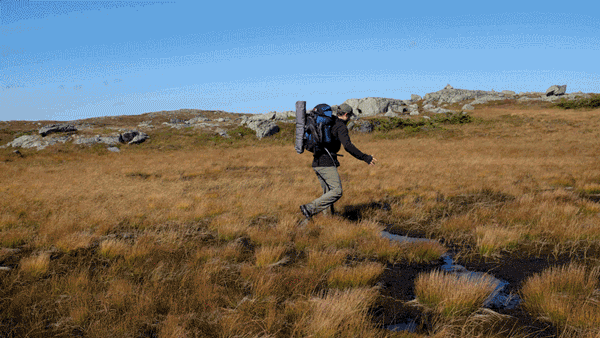
An athletic moment.
By the time we were coming descending to Hardings Pond we were miserable. At the lake’s edge, we passed the other three hikers who we were sharing the trail with. They had set-up camp against the wall of a rangers’ hut—clearly closed—on the shore. It looked like they were boiling water in the outhouse. It was cold. They waved us merrily on, and we trudged grimly through the mud, hoping for a sheltered camping spot.
Soaking next to Hardings Pond.
Nothing to be found — the platforms on Hardings Pond are clustered along an exposed beach. Beautiful, no doubt, in fine weather. It didn’t look like it now. Mishy had started uncontrollably shivering. Joe followed. We set-up the tents side-by-side on the tent platform to create a little area screened from the wind. It kinda worked, and at least, with the tents up, we were protected from the cold. Recovery was on the way.
Day 3: We See a Moose
The next morning was sunny.
Morning at Hardings Pond(photo courtesy of Anton Troianovski).
As we were getting moving, the other hikers cheerfully passed us: “We were worried about you guys last night!” Yeah. Sure. What were they expecting to find? Our frigid little bodies, desperately spooning in the Gros Morne mud? At any rate, we were triumphant and so fortified by survival, forged on. Hump day. Battle legs forged, the planw as to push on, well, as far as we could. At this point, somewhat to our surprise, we’d scarely made it half-way. The blithe travelogs of the more capable taunted us, as we scrambled to make up time.
Today, I would say, was also the first real “trail-less” day. Much had been made, with the test, the emergency beacons, etc., of how there wasn’t much of a trail. That wasn’t our experience. For most of the trip, we followed a well-marked and fairly obvious trail. Along ridges, there were often cairns, and in some dense forested portions, pink-flagged ribbons marked tricky passages. In general, by West Coast standards, I’d say, this was a well-marked trail. Perhaps not like the AT or something, flagged by distinctive blazes or signs—but still pretty good. This day was the tricky one, as it were, but we were patient with the maps and the GPS, and never got too far out track. We had a few good moments of “rediscovering” the path, but nothing ever got particularly dire. We also saw a moose! A huge bull standing probably 50 yards off the trail. He moved fairly quickly off into the tuckamore, but we got a good long look. Though we saw a lot of tracks, we never saw any elk.
Low-grade navigational despotism…
We did run into a dicey spot, but teamwork (and A-plus photojournalism) prevailed.
At some point late in the afternoon, Jon’s boot disintegrated entirely. After four days of constant moisture, the rubber sole just fell off. Pretty miserable. He swapped into some crocs, but that didn’t seem much better. Wet, wet, and nasty.
Redemption came, though, in where we decided to camp that night, on a bustery cliff overlooking an astonishing gorge.
Overlooking some magnificent spot.
Huddling for warmth.
Hot cocoa, moonlight, manliness.
We had couscous and sausage, which was delicious (though instantly cold). Anton made some little European tea and jamm thing.
Day 4: A Return
From where we’d camped, we were already on the high-plateau just north of Gros Morne itself. We had a solid hike ahead, but there wasn’t much concern that we’d be lost or not make it. I think we were all pretty ready to call it quits, though. The descent into Ferry Gulch was a little harrowing, a vertical scramble anchored by muddy roots. One of the least pleasant parts of the entire hike, really, was the walk out from under Gros Morne, which was a couple of miles on loose scree, followed by another hour or so through low, enclosed forests to the trailhead.